|
13th
October 2004
The pictures below illustrate the catastrophic effect that such
heavy rain has where it issues from the 2.5km culverted section
into Coy Pond Gardens; all were taken between 12:35 and 13:05 pm
on 13.10.06: |
|
 |
|
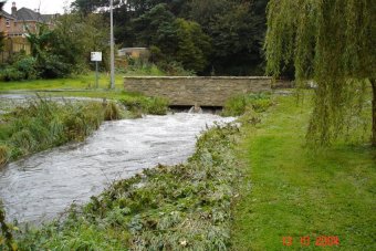
Above:
The control structure in the new bridge is operating at full
capacity |
 |
|
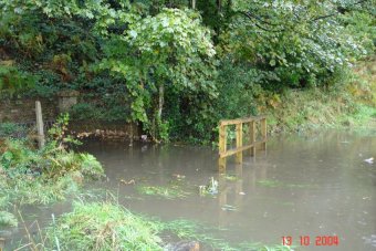
Above:
The new wooden footbridge in front of the culvert is completely
underwater
|
 |
|
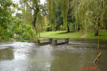
Above
(looking south)
& below (looking north): The stream has filled the floodbasin, although
there is still a narrow dry border thanks to the terracing
created when the floodbasin was created. |
 |
|
Above
& below: water levels fall off dramatically during less
heavy rainfall (in about 10 minutes) |
 |
|
The gardens
further downstream fared
little better: |
 |
|
Above
& below: both bridges downstream of Bourne Pools are completely
impassable
|
 |
|
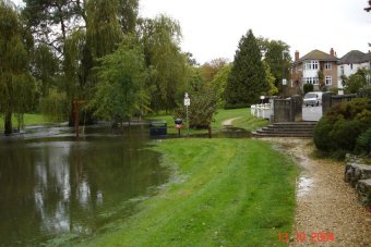
Below:
At the steps leading from Coy Pond Road
|
 |
|
 |
|
Above
and below: the lower end of Coy Pond Gardens underwater
|
 |
|
It's rainfall events such as these
that combine with a rising water table to give the almost
permanently boggy ground in the lower reaches of Coy Pond Gardens. |
|
28th
June 2005 - it's believed that 14mm
of rain fell in just one hour on a June afternoon bringing flash floods
to Bournemouth & Poole, just four days after a night of
tropical-style rain, thunder and lightning
storm.
The results were
spectacular too see, and had wide-spread effects with local homes and
commercial premises inundated by floodwater.
The Bourne Stream burst
its banks and stormwater swamped the public gardens from the railway embankment at
Bourne Pools right through to the Lower Gardens in Bournemouth. |
|
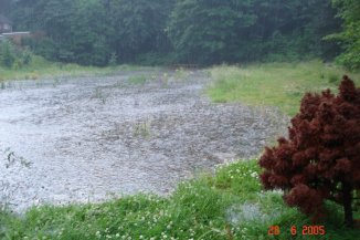
Bourne
Pools (below) bursting at the seams
|
 |
|
And (below) the footpath completely
impassable
|
|
 |
|
In September 2006 the Partnership started work on
a project which could help to alleviate some of the flooding at Coy Pond
Gardens.
At Bourne Valley Park, some 2.5km upstream of the gardens, the stream
has been released from its culvert and 3,500 cu.m. of stormwater storage
created:
|
|
May 2007
- the latest SUDS scheme at
Bourne Valley Park:
Photos below courtesy of
local resident, Glynis Northwood-Long
|
 |
|
Above:
the 2m deep stream channel beyond the bridge, filled with
floodwater, acts as a 'detention basin'.
When it reaches
full capacity water flows through the weir and down the lower
channel and a second detention basin (below). |
 |
|
From Bourne Valley Park water flows
in an underground culvert for 2.5km, discharging at Coy Pond Gardens.
|